How a free app is uniting San Juan County in the fight against marine debris
Published 1:30 am Thursday, April 23, 2026
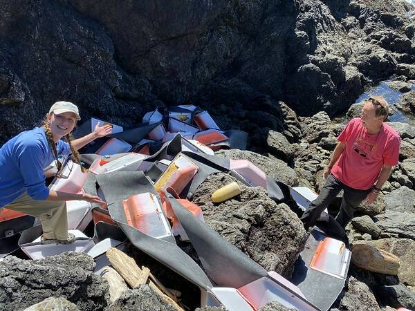
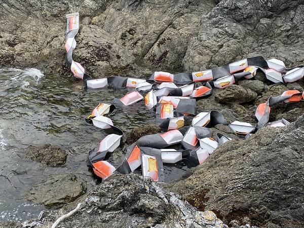


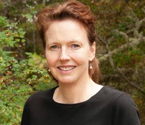
On a rocky stretch of private shoreline in the San Juan Islands, a heavy industrial boom had been wedged between two properties — too heavy, too unwieldy for the landowners to move alone. For San Juan County’s Derelict Vessel Program Coordinator Kari Koski, it looked at first like a dead end.
“At first we were kind of like, ah shoot, we can’t really do anything,” Koski recalled. But she began connecting the dots — a UW grad student, Emily Bews, doing a kelp study was snorkeling nearby. A Samish Indian Nation boat crew was still working in the area, and the Islands’ Oil Spill Association had floating line, shackle bolts and floats she needed. With borrowed gear and a willingness to literally swim a line through Puget Sound, the boom unraveled smoothly and came off the beach without snagging. It was the kind of community collaboration that a new tool — the MyCoast app — is now helping to make more systematic.
MyCoast is a free smartphone app that lets anyone — kayakers, ferry riders, beachcombers — report marine debris, abandoned vessels and extreme weather events in real time. A user takes a photo, the app geo-references it with GPS and the report routes instantly to the right state, federal and tribal agencies.
“We’ve got miles of coastline in San Juan County,” Koski said. “We’re the most amount of coastline of any county in the US, but we don’t have the ability to respond to things the way people would hope and wish.” The County is becoming a partner with MyCoast through its Derelict Vessel Program and Marine Resources Committee, meaning new reports will go to the state, and they will also forward them on to Koski. “The state has a lot of the power to do it, but they don’t always know the local conditions,” she said. “I guess what we’re going to be doing is just a better conduit to help the state do their job better.” At the heart of that state effort is a partnership the Samish Indian Nation has documented on its own website. According to the Samish Nation’s ArcGIS StoryMap — created by tribal GIS Analyst Casey Palmer-McGee — the Samish Department of Natural Resources and Washington’s Department of Natural Resources have worked together since 2014. As of 2024, they have removed over one million pounds of marine debris from the shorelines of Whatcom, Skagit, Island and San Juan counties. The majority has been creosote-treated wood — a century-old marine piling preservative that the StoryMap describes as a cocktail of roughly 30 known carcinogens, steadily leaching toxins into the sediments where forage fish spawn, and from there into salmon, killer whales and humans. “Without the water and life within it, we have nothing,” Samish Indian Nation Chairman Tom Wooten is quoted on the site.
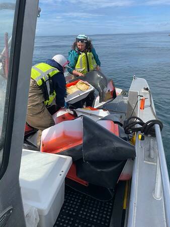
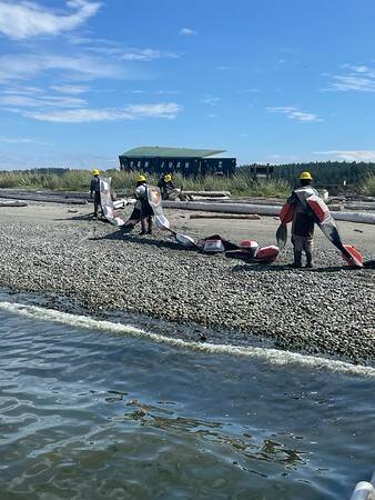
Each spring, Samish DNR crews scout shorelines by boat, binoculars in hand. “March is usually the starting month,” Natural Resources Manager Matt Castle is quoted on the Samish Nation website. “On nicer days it’s easier to spot the creosote and you’re not bouncing around so much using the binoculars from the boat.” Come summer, Washington Conservation Corps, Veterans Conservation Corps and EarthCorps crews deploy by landing craft to haul away creosote logs, Styrofoam dock floats, crab pot buoys, tires, plastics and even entire sailboat hulls — everything transported to a sealed landfill.
MyCoast has transformed how those crews know where to go. “The app kind of blew that all out of the water because we no longer need to be so systematic,” Woodard said on the Samish Nation website. “There’s so many different people out surveying for us.” Since launching in Washington in 2018, the app has gathered more than 9,000 reports and nearly 14,000 images.
When debris lands on private property — which covers much of Washington’s shoreline — MyCoast’s GPS data lets DNR look up the property owner and make contact directly. Landowners can also grant permission for cleanup access through the app itself. The MyCoast app is not only helping to map and coordinate the removal of marine debris — it is also helping to bring together a variety of professionals. “It’s really nice working with multiple state and county and then local community groups,” Koski said. “And citizen scientists. It’s a really nice connection.” As this case shows, that’s what made the boom removal possible. It only came together because of the WA DNR program being present in the islands and a willingness to work together — two willing landowners, Emily Bews, the UW grad student who had been snorkeling the sit for her kelp study, borrowed floating line, shackle bolts and floats from the IOSA with the help of longtime IOSA volunteer Jerry Mcelyea, and a Samish crew still in the area. Koski’s role, she said, was simply the facilitator — knowing the right people to call, knowing that this program existed and just kind of making it happen. “Had we not had that partnership with the state’s programs, we probably wouldn’t have been able to remove it.”
For more information and to download the MyCoast App, go to https://mycoast.org/wa.