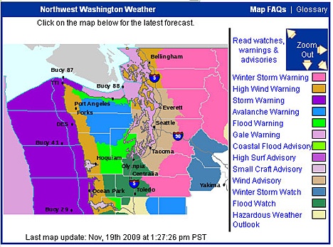
The last in a series of strong low-pressure systems is scheduled to pass through the islands late Thursday afternoon and into the evening, the Town and County Department of Emergency Management reports.
More rain and strong winds are in the forecast, similar to what the islands saw Wednesday night. The peak of the latest round of winds should occur roughly between 6 p.m. and midnight on Thursday.
Gusts upwards of 70 mph last night combined with rain-saturated soils to knock over a handful of trees and cause a wide scattering of power outages across the county. With a similar storm in store for tonight, islanders are reminded that OPALCO has a dedicated outage number (376-3599) with a recording that is updated as soon as info is available. Do not call 911 to either report or inquire about an outage.
“While this storm will hardly be a record-breaker by island standards, as always, residents are strongly encouraged to prepare in advance for winter weather,” said Brendan Cowan, manager of the Emergency Management Department.
Below are some online resources that islanders may find helpful.
— Winter Weather Preparedness: COUNTY DEPARTMENT OF EMERGENCY MANAGEMENT
— Weather Forecasts: NATIONAL WEATHER SERVICE


