
A snapshot of history
Published 1:30 am Sunday, March 29, 2020

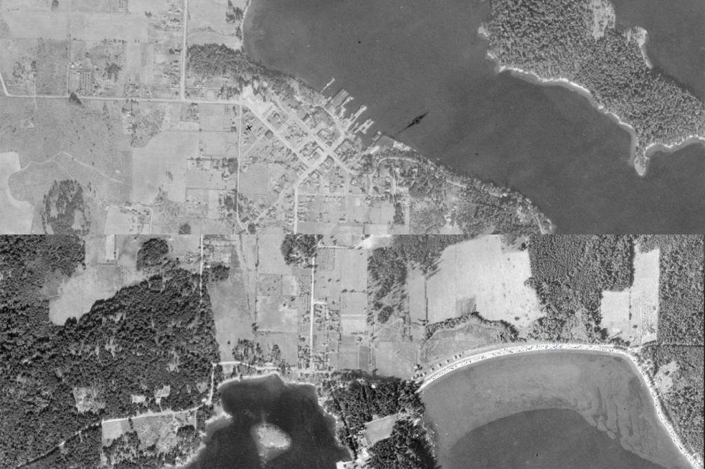
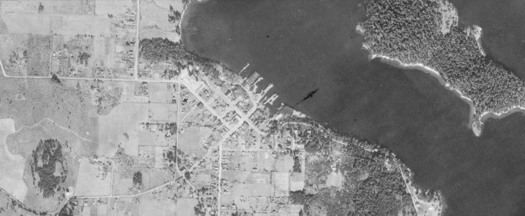


For reasons known only to the Canadian military, in 1932 pilots spent countless hours flying over the San Juans photographing the landscape.
“It’s all speculation, but we are located between Victoria and Vancouver and I suspect they were taking a look at all the channels in the area,” Director of San Juan County Public Works Russ Harvey said, adding that they were essentially gathering geological information in order to best defend their country.
County Public Works and the Global Information System team have put the aerials online as a layer in Polaris. Polaris is the county GIS imaging software. The public may view the map by going to https://sjcgis.maps.arcgis.com/, clicking on “Basemaps,” the button shaped like four squares, then selecting the 1932 base maps. It has been arranged so landowners can zoom in on their property to see what that parcel looked like nearly 90 years ago.
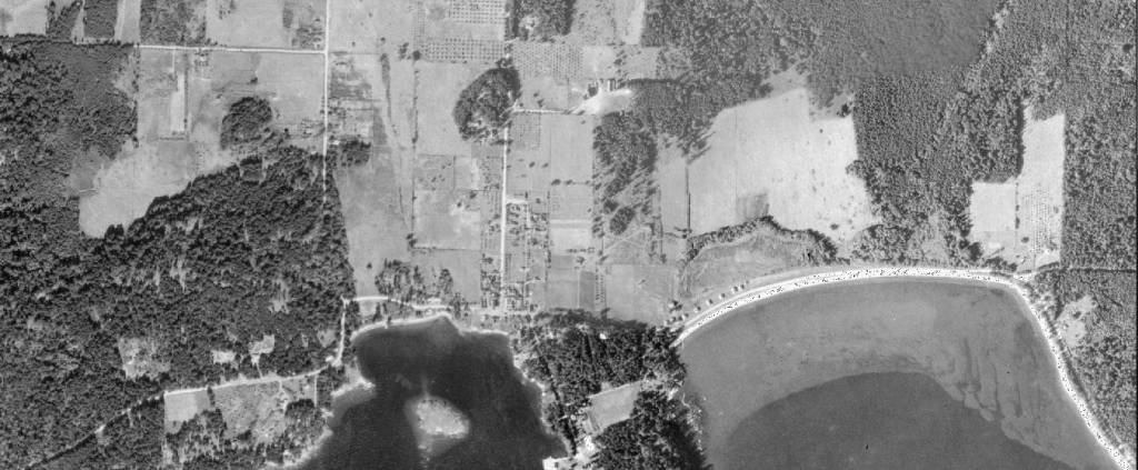
One of the first things people might notice is how barren all the islands were.
“Native Americans burned a lot of trees because they harvested Camas bulbs,” Harvey explained, adding that in order to keep these meadow loving plants growing, they used prescribed burning to maintain open fields.
Farmers also cleared land for produce and the limestone quarries burned a tremendous amount of the forest for fuel in their kilns, San Juan County Public Works Survey Technician Eric Stone, added.
Instead of the Douglas fir forests of today, the islands were historically filled with Garry Oak groves and open savannahs.
“It was very much a farming community in those days,” Harvey said. Local land surveyor Patrick Kirby echoed those sentiments.
“Agriculture was quite strong in the county, and looking at the photographs you can see all the orchards and apple trees,” he said. Kirby also added that in his effort to gain information about the county from the ’30s-’40s, he had not found any aerials as clear as these until 1951.
What surprised Harvey, he continued, was to see how much of Roche Harbor was in existence. Friday Harbor was smaller of course, but still very much a town. Eastsound was very small, but the school was in exactly the same place. Lopez Village, Harvey added, did not exist at all. Neither did any of the airports. As a result, people relied on boats.
“You can see several steamer docks,” Harvey said.
Steam-powered and passenger steamer ships were frequently used throughout the San Juans at that time. One dock, Harvey pointed out, was next to the Orcas ferry, another can be seen in the photos off West Sound, and another off Doe Bay.
Another interesting finding Harvey noted was that he had heard from old-time islanders that Orcas Island actually had two ferry docks. Sure enough, Harvey saw in the photographs a second dock located on the north side of the island. Harvey explained that there were two attempts to create a ferry service to Bellingham but both failed. One reason for the failures may be that the north end while being the closest to Bellingham, is also more exposed, he said.
Stone pointed out that Lake Dale on San Juan is essentially a manmade lake was primarily farmland in 1932. Natural ravines were expanded in later years, to become the lake is today.
Harvey, who came to Orcas Island as a boy in the early ‘60s was surprised also by the amount of roadway already laid out in the ‘30s.
“Obviously more roads have been built, but to me, the person that now takes care of roads, I was surprised by the main arterials already there,” Harvey said.
According to Stone, the Canadian military reached out to Washington state to see if they were interested in the mass of individual photographs. The state said yes, and in turn, asked San Juan County if they wanted them. Public Works took over the project of turning them into a usable document.
To understand how much work and dedication was put into creating this document for Polaris, Stone explained the history of aerial photography. The very first aerials were taken between 1870-1880 from hot air balloons. By the 1930s photograph technology had been developed further, but most of the photos taken at the time were what Stone called oobleck — meaning taken out of the plane at an angle rather than straight down. Planes, Stone added, could only be flown for a few hours at a time, so the entire project must have taken the Canadian military months to complete.
“They put a lot of effort into these photographs,” Stone said. “We aren’t sure why. That’s kind of the elephant in the room question.”
Adding to the mystery, Kirby explained that during the early thirties tension was actually quite high between the United States and Canada, with Canadian spies found in other states like Vermont.
Whatever the reason for the aerials’ existence, they are not only an interesting snapshot of a place in time, they can be a useful tool for landowners, Stone said. Should a farmer want to build a barn, for example, and these photos show there had been a barn on the property, that farmer could use that information to help get the necessary building permit.
Seeing how the island’s environment has changed over the years and how people have altered the landscape has been eye-opening, Stone said, adding that he is part of the committee trying to create the Old Military Road Trail which would connect American Camp on the south end of San Juan Island to English Camp, on the northwest side of the island. As the original trail is visible in the 1932 photos, the group is using them as a guide for its plans. Kirby also explained that the photos could also be used in environmental areas like salmon recovery, as they give a snapshot of what kind of vegetation grew along riparian, or river and wetland, areas.
“A photo describes everything – answer questions you haven’t even asked yet,” Kirby said.
“These aerials are pretty special, I encourage people to take a look at them,” Harvey said.